Marti Miralles Arquitectes
DeveloperREGESA
LocationCarrer Albéniz and Carrer de l’Estadi, Badalona
Project2003
Construction2006
Floor area6,224 m²
External consultants
Joan Ramon Soldevila (Q. Surveyor), Rafael Bellmunt (Structure), Oficina Tècnica Lluís Duart (Facilities)
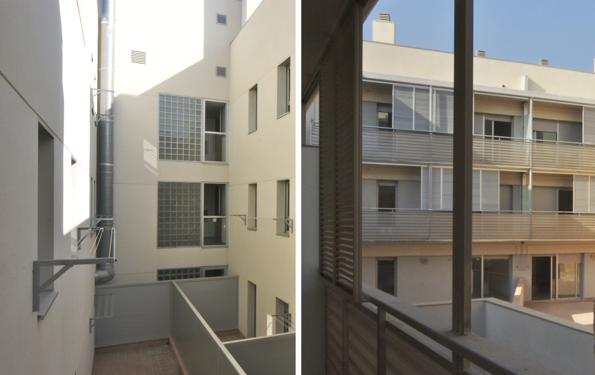
The ground elevation inside the block is 6 to 10 metres above street level, producing differences of up to 15 metres between the highest point inside the block and lowest at street level. Two types of buildings coexist on this block, making different uses of the plot.
The narrowest plots with older buildings, which are constructed with very simple methods and light materials, have a main section in line with the street facade, which in many places has become uneven as the streets have been developed. The back of the plot is reached through this main section and via a narrow passage and set of steps. The foundations of these constructions sit directly on the earth and there is a system of load-bearing breezeblock walls with joisted one-way roofs supported directly on the walls with no bracing.
This kind of building style; spontaneous, densely packed and unregulated, resulted in subsidence due to the cumulative effect of improvised makeshift constructions. The 1952 Regional Plan and the 1976 General Metropolitan Plan introduced a perimeter block layout, bringing radical change to the building model by grouping plots together and replacing buildings. Private developers carried out these projects in the 1970s, resulting in a significant change to the topography of the upper part of the block.
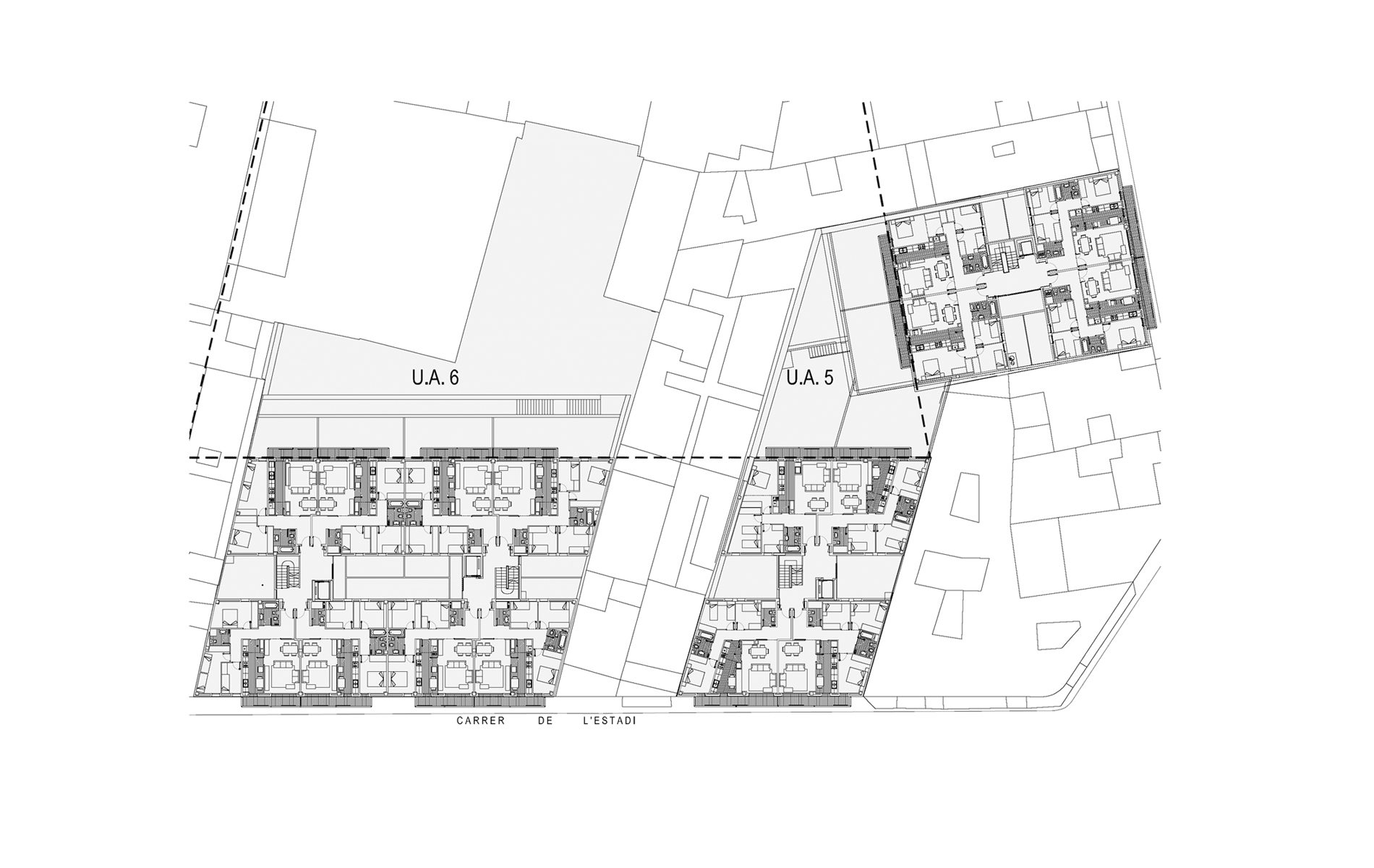
A public operator needed to intervene to drive this transformation forward and take charge of the most complex area. With this aim in mind, the General Metropolitan Plan of 1976 demarcated local development areas UA5 and UA6 to make the operation manageable. An area of 12 m occupied by fairly precarious buildings separates the two units; this is not included in the remodelling we carried out.
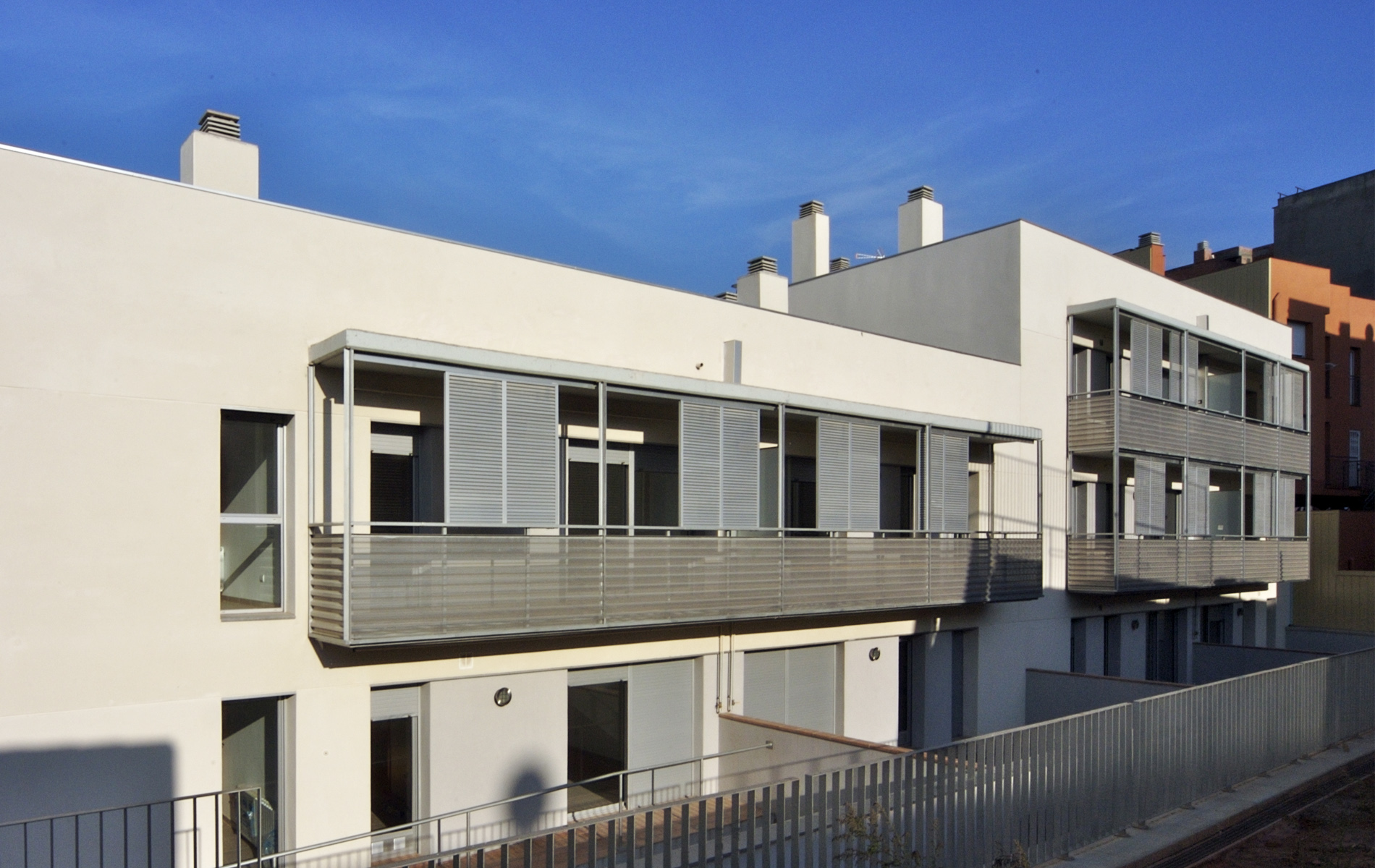
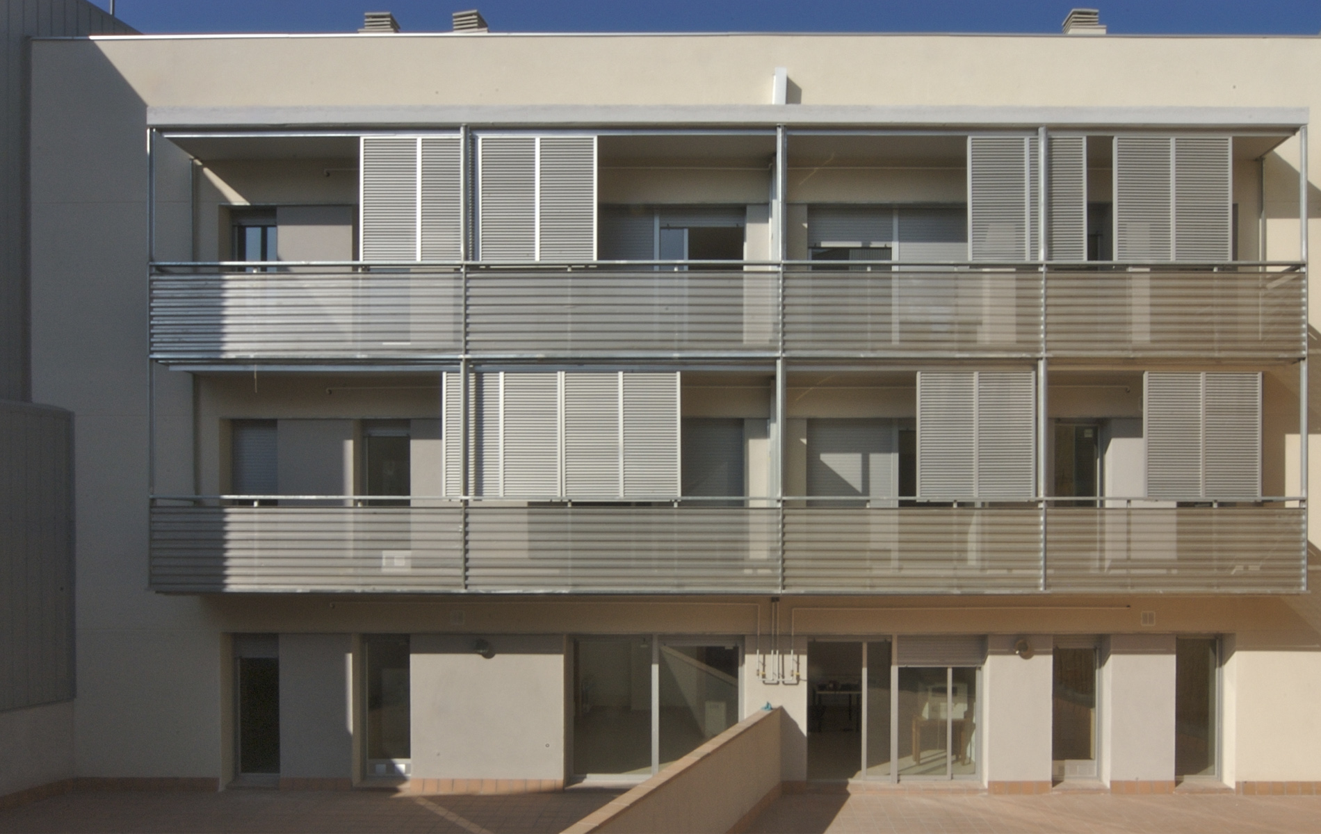
The aim of the project is the construction of three buildings with ground plus two floors above street level with a total of 36 dwellings, three retail units and a car park with 57 spaces. The ground and basement floors adapt to the lie of the land and street levels through architectural solutions particular to party wall construction.
The narrowest plots with older buildings, which are constructed with very simple methods and light materials, have a main section in line with the street facade, which in many places has become uneven as the streets have been developed. The back of the plot is reached through this main section and via a narrow passage and set of steps. The foundations of these constructions sit directly on the earth and there is a system of load-bearing breezeblock walls with joisted one-way roofs supported directly on the walls with no bracing.
This kind of building style; spontaneous, densely packed and unregulated, resulted in subsidence due to the cumulative effect of improvised makeshift constructions. The 1952 Regional Plan and the 1976 General Metropolitan Plan introduced a perimeter block layout, bringing radical change to the building model by grouping plots together and replacing buildings. Private developers carried out these projects in the 1970s, resulting in a significant change to the topography of the upper part of the block.
A public operator needed to intervene to drive this transformation forward and take charge of the most complex area. With this aim in mind, the General Metropolitan Plan of 1976 demarcated local development areas UA5 and UA6 to make the operation manageable. An area of 12 m occupied by fairly precarious buildings separates the two units; this is not included in the remodelling we carried out.
The aim of the project is the construction of three buildings with ground plus two floors above street level with a total of 36 dwellings, three retail units and a car park with 57 spaces. The ground and basement floors adapt to the lie of the land and street levels through architectural solutions particular to party wall construction.
